 OSU Pytheas - Data Catalog
Bay of Biscay
Type of resources
Available actions
Topics
INSPIRE themes
Keywords
Contact for the resource
Provided by
Formats
Representation types
Update frequencies
status
Scale
-
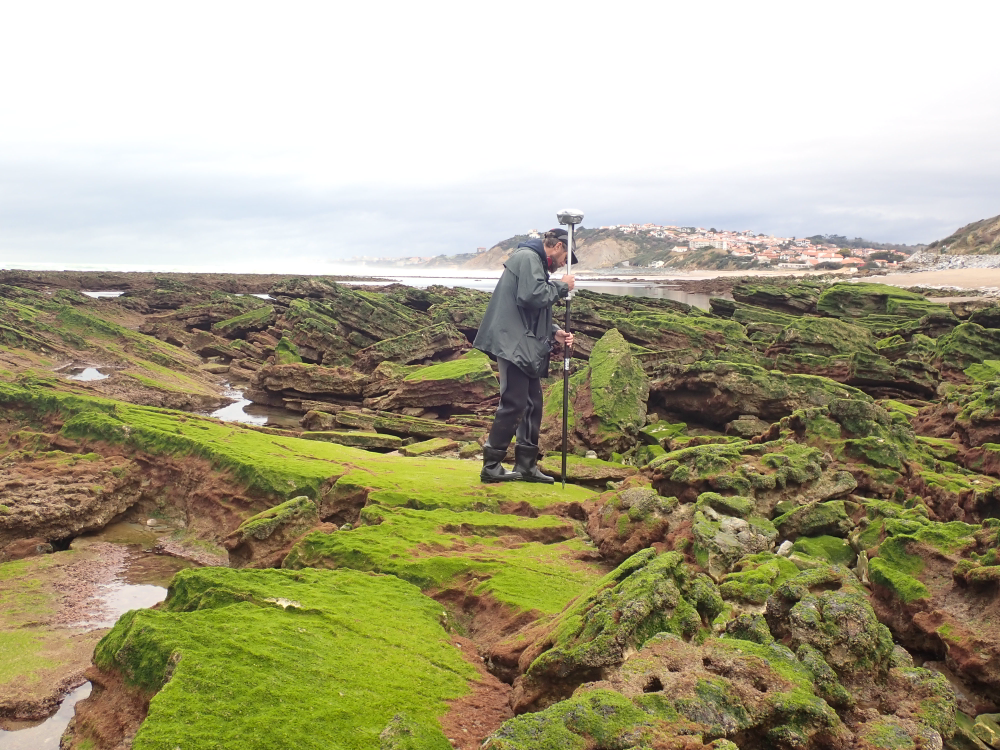
The present dataset is based on a nine site study of fine seabed topography in intertidal zones. Four coral sites (Maupiti A, B and C and Niau islands) and five rocky sites (Ars en Ré, Socoa, Parlementia A and B and Banneg island) have been explored. The data has been gathered using on-foot GNSS RTK for all sites (Trimble R8/R8S and Leica sytems) except Banneg island, where aerial Lidar data from Litto3D program has been used. The horizontal resolution varies between 3.8 and 12cm allowing to describe a wide range of spatial scales (generally over 3 spectral decades). The data has been processed to explore the statistical and spectral metrics which can be used to characterize the architectural complexity of seabeds. Owners: - Topographic survey on Ars-en-Ré : profile X, Z in meter along a transec was operated on 10-15 Jan 2021 with On-foot Trimble R8/R8S GNSS RTK by Shom, Gladys and Univ. de Montpellier - Topographic survey on Maupiti Hoe: profile X, Z in meter along a transec was operated on 5-10 July 2018 with on-foot Trimble R8/R8S GNSS RTK by GLADYS and Université de Montpellier - Topographic survey on Niau : profile X, Z in meter along a transec operated on 10 Nov. 2021 with On-foot Trimble R8/R8S GNSS RTK - by CEREGE and MIO (OSU Pytheas) - Topographic survey on Parlementia A, and B : profile X, Z in meter along a transec was operated on 22 Fev 2023 with on-foot Leica GNSS RTK by SIAME, UPPA - Topographic survey on Socoa : profile X, Z in meter along a transec was operated on 21 Fev 2023 with on-foot Leica GNSS RTK by SIAME, UPPA and Shom - Topographic survey in high resolution of Banneg island (X, Y, Z) is made by aerial lidar litto3D on spring 2012/2013 by Shom and IGN
-
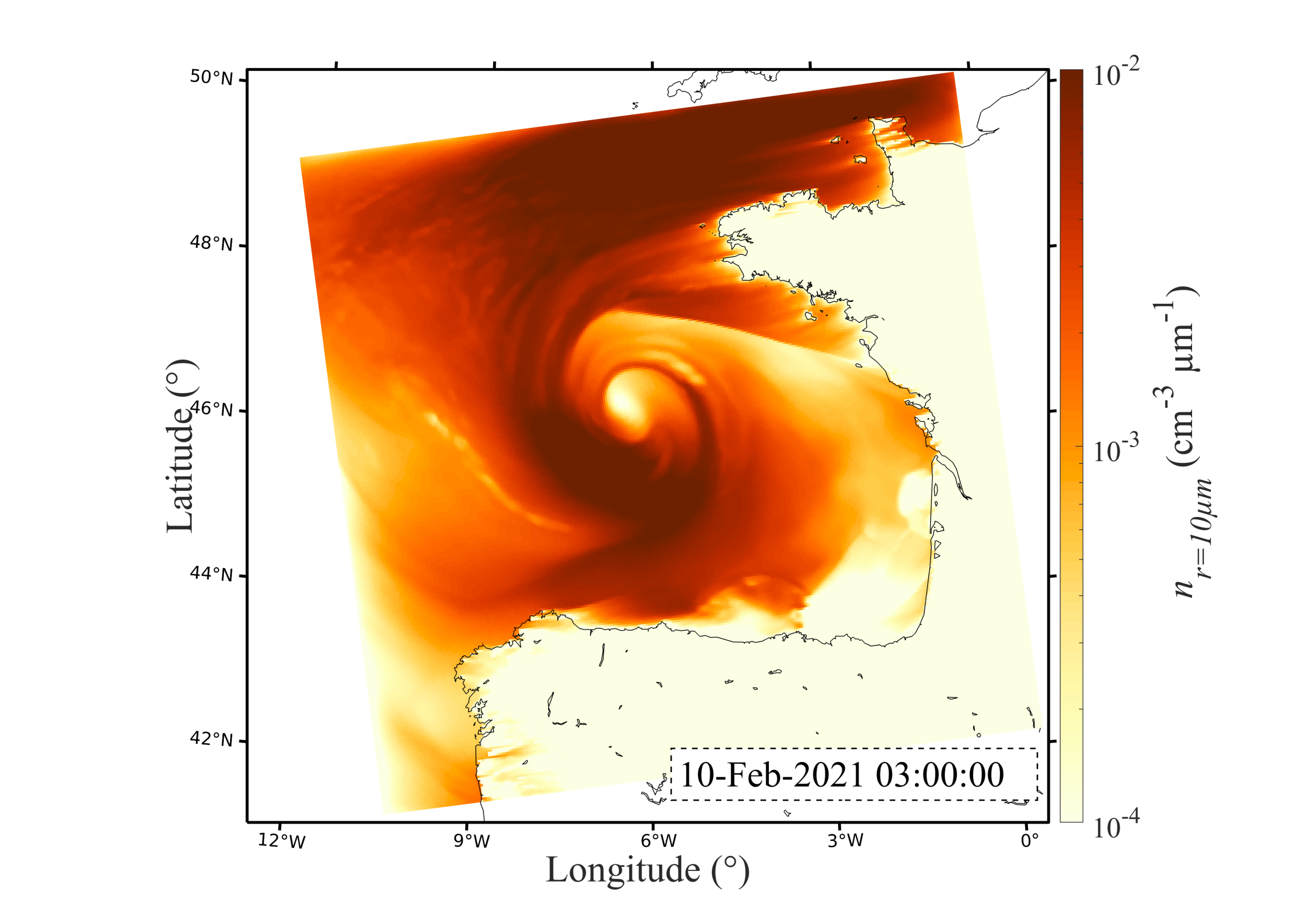
In the context of the SUMOS research cruise (2021) where sea spray concentrations were measured in February and March 2021 in the Bay of Biscay, the present dataset gathers numerical simulations of sea spray transport achieved with the MesoNH model. This dataset gathers MesoNH model outputs every hour over a 600x600km grid (300x300 cells) centered over the Bay of Biscay. The model was forced using the ECMWF model every three hours. Three sea spray generation functions are used to parameterize the sea spray generation flux: OVA14 (Ovadnevaite et al. 2014), B21A and B21B (Bruch et al. 2021). Modeled number concentrations are extracted at 2 µm radius for OVA14, and 2, 5, 10 and 20 µm for both B21A and B21B. The database presents these concentrations along a horizontal cross-section across the entire domain at 15 meters above mean sea level. This data is presented as 3D matrices structure as follows : Time x Longitude x Latitude. The database also provides the number concentration distribution as a function of particle radius (n(r)) at the location nearest to the Atalante vessel. Both horizontal wind speed components U and V are provided over the entire grid, as well as the horizontal wind speed sqrt(U²+V²) at the location nearest to the Atalante vessel. Units : Wind speed (m/s), number concentrations (#/cm3), Longitude and Latitude (Degrees). More information about the dataset can be found in the publication by (Bruch et al. 2023 – JGR – Atmosphere).